|
|
|
|
|
|
Background Information
Community Information
Cumberland
was around before Benham and Lynch, though with the name “Poor Fork.”
It was a small market town serving the agricultural base of pioneers in
the Poor Fork and Looney Creek valleys. The surrounding mountains
isolated the valley until the early 1900s, when rising demand for the
high-quality coal attracted subsidiaries of Wisconsin Steel and U.S.
Steel. Their plans to mine coal out of the earth provided the
impetus for the first rail line into the Cumberland Valley–the
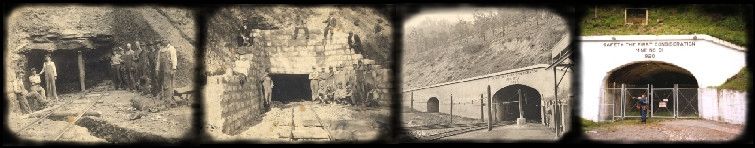
L&N–and for a commercial boom in this town. Wisconsin Steel began to build Benham from scratch in 1910,shipping its first coal in 1911. It was intended to be a model town that would attract the best miners and serve the needs of them and their families. They planned and constructed neighborhoods, schools, a company store, a hospital, and governance. Likewise, U.S. Steel built Lynch from 1917. It was hailed in popular national magazines a model community. Its mines, like those in Benham, produced tons of metallurgical-grade coal a day, beginning with breast augers, dynamite, hand loading, and pony carts. Over the decades technological changes increased production and safety but decreased employment both here and throughout Kentucky’s mines.
The
United States Coal & Coke Company purchased 40,000 acres of
mountainous timberland in the Appalachian Mountain Range located in
Eastern Kentucky and built a coal mining operation here that would last
over a period of 60 years. This town was named for Thomas Lynch who then
served as the Chief Executive Officer of
Description of Area
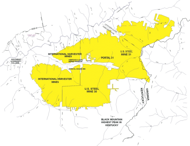
Portal 31 is located in Harlan County, near Lynch, Kentucky.
The area lies within the Eastern Kentucky coal field which is
divided into six separate coal districts.
Portal 31 is in the Upper Cumberland River District (Harlan Sub district). The Eastern Kentucky coal field is a hilly to mountainous
region. Black Mountain, the
highest point in Kentucky lies just to the south of Lynch at an elevation
of 4139 feet above sea level. The topography of this area is steep with high ridges and low hollows. The terrain is typical of that of the Appalachian Plateau physiographic province, well-dissected and well-drained by deeply entrenched streams. Ridges are generally narrow and winding. Natural flat land is mainly restricted to flood plains of major creeks and rivers. Low-order streams are generally V-shaped and have no flood plains.
Stratigraphy The geology at Portal 31 is typical of the Breathitt Formation. The coal seam that was mined was locally called the “C” coal bed (see correlation chart). On the Benham and Appalachia Geologic Quadrangle Map, the coal seam is correlated as the Darby. In Virginia, this seam is referred to by a third name, the “No. 5". Another coal seam, the “B” or Kellioka was also mined in the Portal 31 area see Typical Stratigraphic Section and Coal Seam Correlations.
Structure
Structurally, Portal 31 lies between Pine Mountain to the northwest and
Cumberland Mountain to the southeast, on what is called an overthrust
sheet. Pine Mountain is a
thrust fault; a thrust fault is a tear in the upper part of the Earth’s
crust along which one block of strata is pushed up and over
another block of strata. Pressures
from mountain building caused the northeast edge of this block of
Geologists can trace the amount of movement on the fault. The northern portion of Pine Mountain has been pushed 4 miles from its original position. The southern edge in Tennessee has been moved 11 miles. As part of the overthrust sheet that moved along with Pine Mountain, the area that is now the city of Lynch was pushed between 4 and 7 miles from where it started. |
|
|
|
|